The Lower San Pedro Area
[ from Redington Bridge to the confluence with the Gila River ]
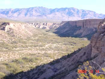
The San Pedro floodplain broadens considerably downstream from the Pima County line. North of Redington, below, looking toward the northwest from a terrace near the Davis Ranch. Some major archaeological sites from the Hohokam Classic period (A.D. 1200-1450) are found in this part of the valley. Some of these sites show cultural connections with the Hopi and other Puebloan peoples far to the north. For more details, see the article by Jeffrey Clark & Patrick Lyons.

Below, the San Pedro runs from right to left, with the northern Galiuro Mountains in the background. As usual, substantial, high terraces continue to flank the floodplain at many points along this part of the river, but the mountains rise further away.(December 2002) Click on the image to enlarge it.
 The ADOT I-10 Bypass Alternatives Map at left shows the two options swinging away from the river north of Redington. (Click on the map to enlarge it.) This area is largely out of our scope of assessment, but since the lower portions of the river valley would be massively affected if either choice became reality, we briefly note the terrain here.
While the route looks clear and smooth on a map of this resolution, the picture becomes more wrinkled when a topo map is used. Where the two Alternatives merge near the Pinal County line, the Highway would pass across Alder Wash, visible on the map below at bottom left.

Alder Wash runs down from its source near Loma Linda at the top of Mount Lemmon and hence occasionally carries a lot of water (and, after the fire, organic debris). While it looks fairly modest on the above Topo map, it is a deep, rugged canyon in its upper reaches and a very expansive structure down below. Witness this image, below: from the Cascabel/San Manuel Road we look out westward at the broad expanse of lower Alder Wash. The wash is running down toward the viewer, from its source in the central Catalinas (note by the way the big stand of very old Saguaros located on the terrace at far right):
This wash would require very massive bridging, and it is only one of a series of paralleling Mount-Lemmon-draining washes here, including Stratton Wash, Catalina Wash, and of course the better-known Peppersauce Wash, where current State Route 76 ends (and presumably our merged Alternatives would now connect).
On the map below, see Alder Wash running down from the Catalina Mountains. Directly across from it lies a much deeper wash, in Kielberg Canyon, which drops to the River from the closer slopes of the Galiuros. Together the two washes form a continuous wildlife corridor connecting the Catalina and the northern Galiuros.

Below left : Kielberg Canyon viewed from Alder Wash, looking East; China Peak of the Galiuros rises in the background (July 2002): below right: Kielberg Wash looking upstream from High Mesa: (click on each image to enlarge it.)
This wash (above) runs past Pliocene lakebed-deposit cliffs (see "Quiburis Basin Geology") which are visible on both sides of the Canyon, to its confluence with the San Pedro, where the floodplain is very broad and sandy (below, looking eastward toward the outflow of Kielberg Wash):

Further downstream, near Whitlock Wash (and near San Manuel), the waters of the San Pedro surface again at a road crossing:

At this point we have come very close to the tailings ponds of the San Manuel Mining operation.


